
Voice of the Danube
26 February 2024
Modern water resource management is data-driven and relies on input from a huge variety of sources ranging from historical statistics to real-time satellite monitoring. Distilling valid evaluations and reliable forecasts from the flood of available information is a science in itself, and a one-stop tool to create instant situational awareness would be a real game changer in this field. Which is where IAWD member Mozaika comes in. Read here about the state of things – and meet Mozaika at the Bulgarian Water Conference on World Water Day.
Threats to water resources are threats to public health, prosperity, stability – actually, to civilization itself. Chronic water scarcity and lack of access to safe drinking water and sanitation services are widespread, and hydrological extremes like floods and droughts are expected to intensify as climate change unfolds. In the face of the rapidly growing challenges, cutting-edge water resources management is key to the sustainable use of this critical asset, and also to the safe and efficient operation of infrastructures like dams.
Water resources managers work with daily updated information about dam and river conditions, water economics, weather reports and forecasts, and the general state of the natural environment. It is their job to connect the dots in these heterogeneous data to evaluate sometimes fast-changing situations and make informed decisions about water discharge activities, fairways, maintenance schedules, and emergency responses.
Poring over data gathered from widely varying sources presented in a plethora of formats like excel sheets, files, databases, remote sensor inputs and satellite photos, water resources managers and decision makers would very much appreciate a one-stop tool that integrates all data and provides clear insight and analytics for operational, planning and disaster decision making.
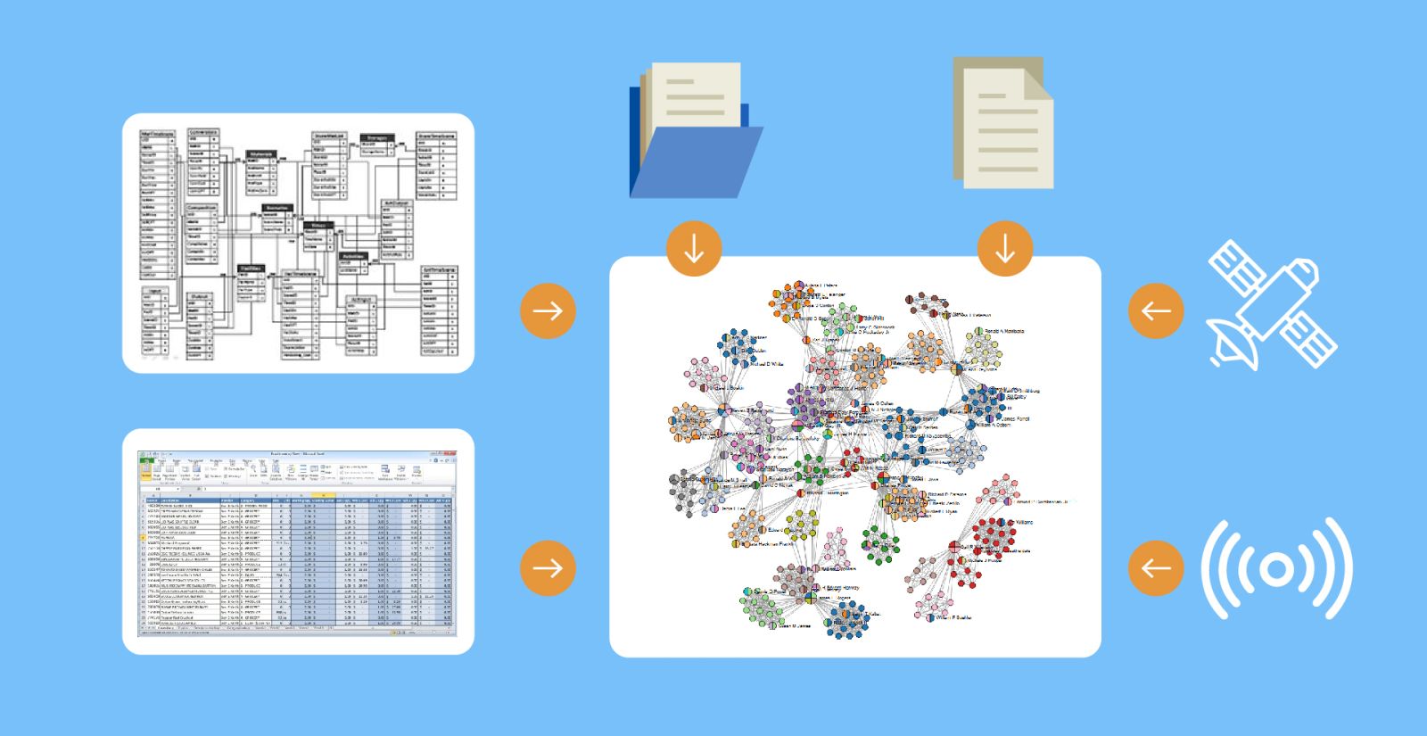
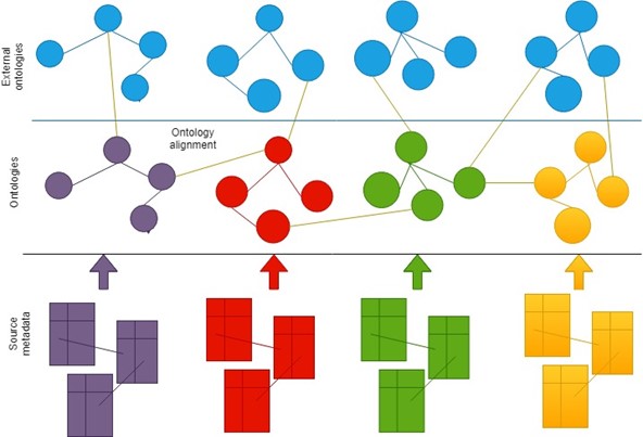
Linked Data technologies are a disruptive approach in information delivery. They enable the creation of knowledge value chains mixing and processing data of all types, efficiently converting them into insights. Linked Data produce a network of connected objects harvested from different heterogeneous sources, and allow the application of methods to search, compare and browse graphs (see Figure 1). Thus, they enable distributed knowledge discovery, providing an explainable way to access information independently from its location.
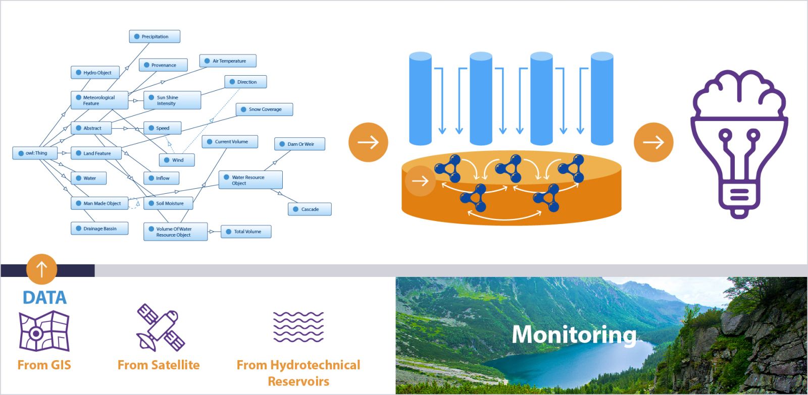
Linked Data technologies provide with superior data handling capabilities, allowing the creation of web-based workflows that use explainable Artificial Intelligence methods and provide viable, hands-on solutions. They provide integrated representations of spatial, digital, and symbolic data and images, interlinking them in an open, easy to maintain, up-to-date and reliable information infrastructure of interoperable heterogeneous data. Spatial information, remote sensing information, symbolic and numeric data can be put together via an ontology and provide the ability of knowledge discovery in explainable manner (see Figure 2).
Linked Data are a very suitable technology to help water resources management, efficient daily hydropower reservoir monitoring and decision-making support in maintenance, routine exploitation and emergency situations. In-situ measurements are interlinked with domain knowledge, geospatial information, forecasts, river dynamics and many more.
Mixing different AI methods Linked data create powerful e-Infrastructures that process all kinds of available information, generate forecasts, formulate queries, issue alerts and drive the communication with the users. Hydrological forecasts and river dynamics become part of the overall data flow (see Figure 3). They have the capacity to involve Big Earth Data - massive Earth Observation (EO) datasets, into the e-Infrastructures flows and turn this data flood into usable information layers by adding and combining them with all other integrated data. The potential of EO data as a relevant source of information for water resources management is gaining attention.
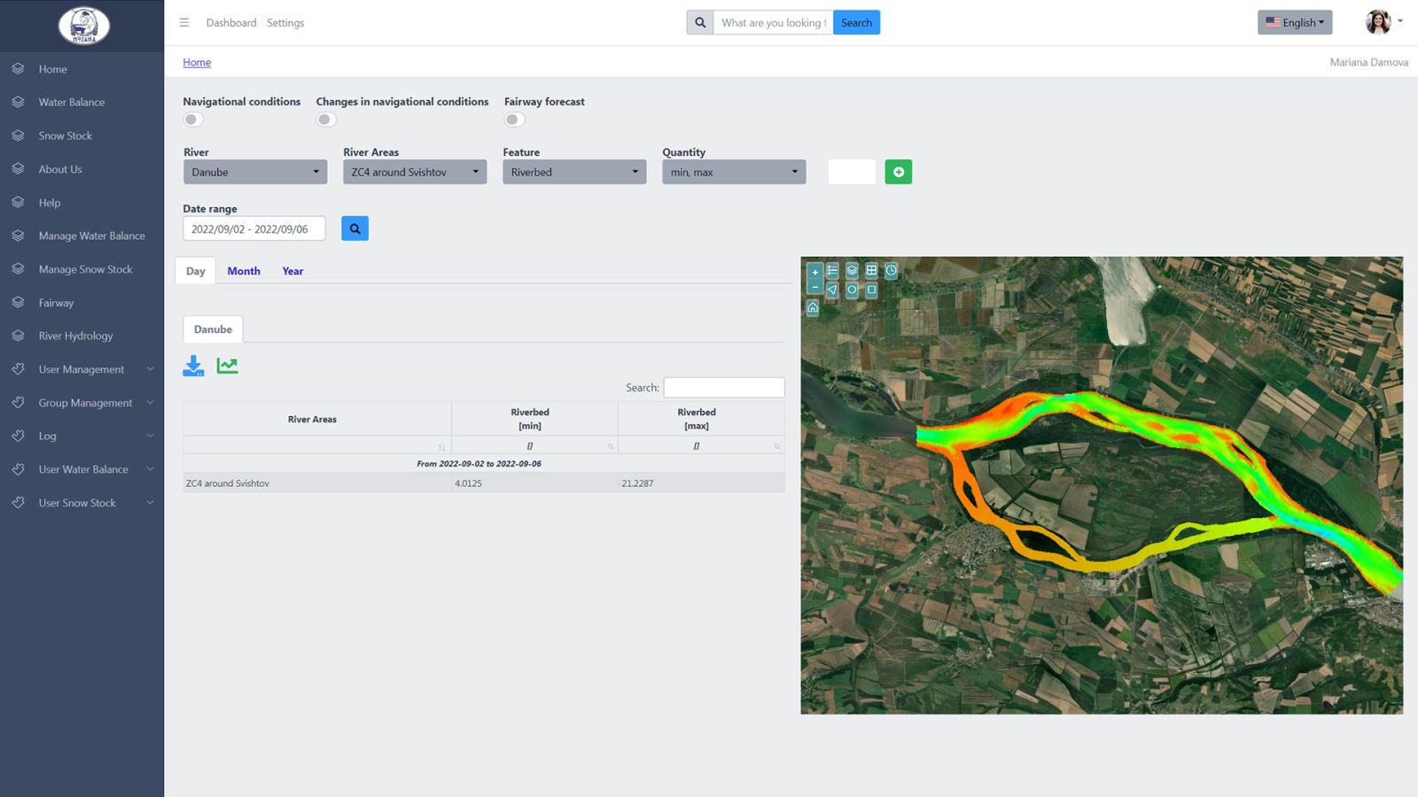
This provides end users - water resources managers, planners and decision makers - with a tool to navigate through historic and future data in various correlations. Users can ask the system questions like, e.g., “what was the amount of the precipitation and the soil moisture when the water volume of a dam X was on its maximum during the past 10 years”, or review the snow cover at a time when the water level of a given cascade was above a certain level, or inquire what the riverbed in a particular river area will look like if the discharge exceeds a certain amount in the next 10 days, and so on. The system will respond with synchronized figures in a table and on a graph and a map view of the satellite data, the dam or the river area in question (see Figure 4).
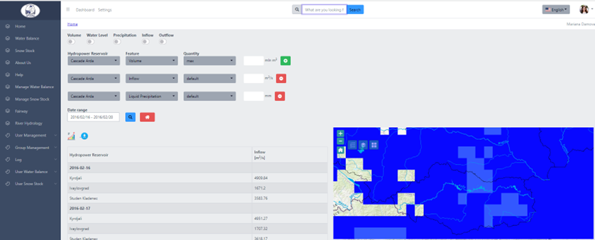
Compared to the state of the art GIS (Geographic information systems) and SCADA (Supervisory Control and Data Acquisition) systems, Linked Data technologies present an optimal standardized framework to handle heterogeneous data, allowing easy data integration, resource efficiency and seamless extendability of the required information. With Linked Data technologies it is possible to extend the capabilities of the e-Infrastructure efficiently and cost-effectively without the necessity to redesign or re-engineer parts of it, but by only rekindling the data and the vocabularies involved (see Figure 5). Further, Linked Data technologies provide superior interactivity with the data. Analysists and system operators can search out all kinds of data correlations at their convenience, and review past statuses or analytics. Linked Data-based infrastructures can combine logical with numeric reasoning and integrate with GIS visualizations.
Data is the world’s great new natural resource, claims former IBM President and CEO Ginni Rommetty a couple of years ago. Data shape the 21st century as thoroughly as steam power shaped the 18th, electromagnetism the 19th, and combustion engines shaped the 20th century. Linked Data technologies provide a very powerful instrument to master a wealth of heterogeneous data in explainable manner, allowing computers and humans to collaborate safely, smoothly and efficiently. Which holds a huge promise for water resources managers – and not for a distant tomorrow, but for here and now.
The Bulgarian information e-Infrastructures expert, Mozaika - The Humanizing Technologies Lab presents ISME-HYDRO®, a fully operational solution, implementing the Linked data technologies based approach, described above. Those who are interested in Linked Data infrastructures for the water sector are welcome to visit isme-hydro.com, mail to mariana.damova@mozajka.co – or meet Mozaika representatives in person at the International Conference "Water resources - management preservation and effective use" oganised by Mozaika and hosted jointly with the Bulgarian Water Association on March 21st this year in Sofia to celebrate the World Water Day.