
Voice of the Danube
Water resources management benefits vastly from an integration of earth observation data with other relevant data inputs for monitoring purposes in web-based workflows. ISME-HYDRO® provides a latest generation web-based workflow that supports water resources managers, river and dam operators, and higher-level decision-makers in monitoring dams, rivers and other critical water resources.
ISME-HYDRO® integrates earth observation, in-situ data, geospatial information and domain knowledge to provide superior usability: Excellent interactivity, multifaceted data visualization, seamless system extendibility, efficient maintenance, and optimized utilization of earth observation, in-situ data, geo-spatial information from GIS, and domain knowledge add up to a smooth workflow.
A comprehensive dashboard makes querying, reviewing, setting alerts for upcoming overflows and droughts, changing navigational conditions, predicting power generation potentials, and many other tasks easy like never before. This is a truly disruptive web-based workflow solution, driven by a combination of AI methods that add up to a powerful e-infrastructure. ISME-HYDRO® is the water resources manager's perfect tool to sustainably exploit water resources, mitigate disaster impacts, and efficiently monitor and assess the water-economic and infrastructure status daily.
ISME-HYDRO® information system has been customized to meet the demands of professional users:
- Water resources managers responsible for monitoring the water and sedimentation status in rivers and dams, including the status of dam equipment and floodplains.
- Water resources technicians, responsible for keeping fairways, live storage, and floodplains information up to date.
- Top executives in enterprises responsible for maintaining rivers, dams and cascades.
- Experts in public bodies, responsible for monitoring water status and impacts of sediment deposition, including flood plains and fairways of navigable rivers.
- On-site technicians responsible for dam maintenance who perform daily measurements and control dam equipment, fairways, and floodplains.
The ISME-HYDRO® information system is built to meet the requirements of both water resources managers and generic users responsible for monitoring dams and rivers. It is a web-based application, built on a linked data-based information infrastructure that integrates semantically meteorological data from satellites, geospatial data from GIS, in-situ measurements and domain knowledge of water resources management.
It offers superior interactivity enabling user queries about the water status in rivers, including discharge, temperature, water level, turbidity, sediments, and navigational conditions. Queries can be made about past and future single days or time periods. The system executes scheduled updates of information about water, sediments, depth and fairway conditions, providing geospatial visualization of the navigational conditions, critical river sections, and meteorological satellite information. System access requires registration and login. Admin, data auditor, and data consumer roles are available, with the admin role handling user accounts. Data auditors are authorized to input, edit, and review data, to schedule, launch and stop automated updates and tools. Data consumers can submit queries, view query results, export data, and interact with data.
The user interface has the following features:
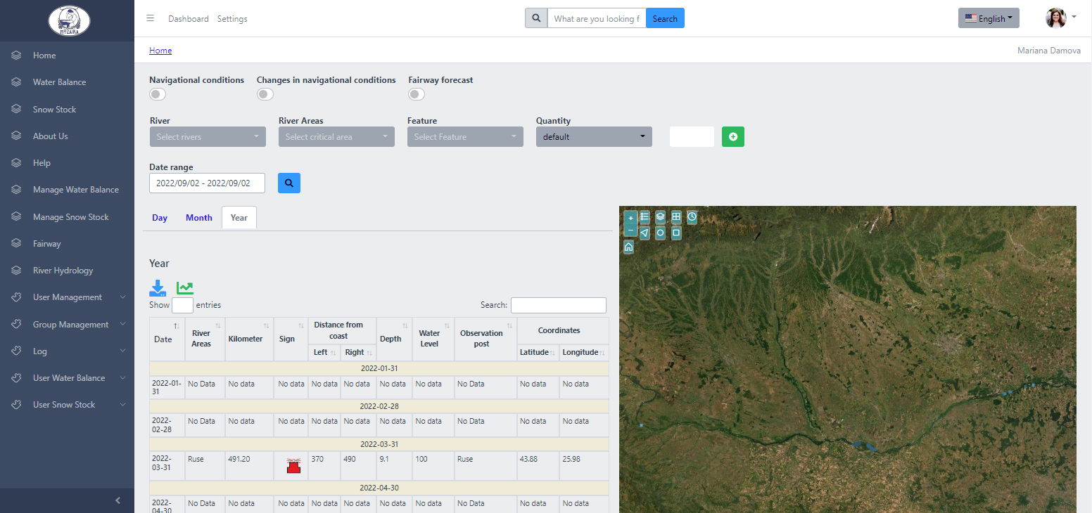
- a dashboard where information is displayed in three panels:
- default information table,
- query results panel,
- maps view panel
- a vertical navigation panel gives users choices to select use cases like Fairway, River Hydrology, Water balance, Snow Stock and other relevant topics.
- Three search modes are available:
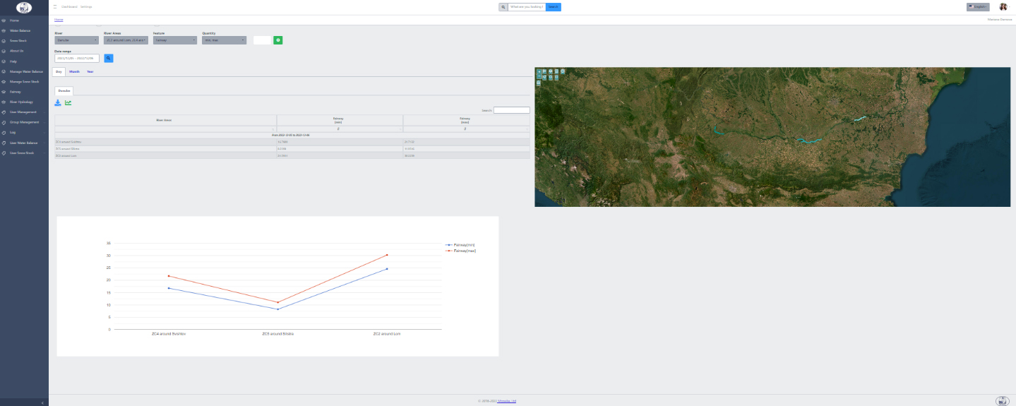
- Shortcut buttons are contextualized according to the selected use case and allow quick access to prepackaged information. For example, for the use case Fairway, the provided contextualized shortcut checkboxes are: Navigational conditions, Changes in navigational conditions, Fairway forecast. The shortcut checkboxes are designed to launch predefined semantic queries and deliver the corresponding results in default information table panels and map view panels.
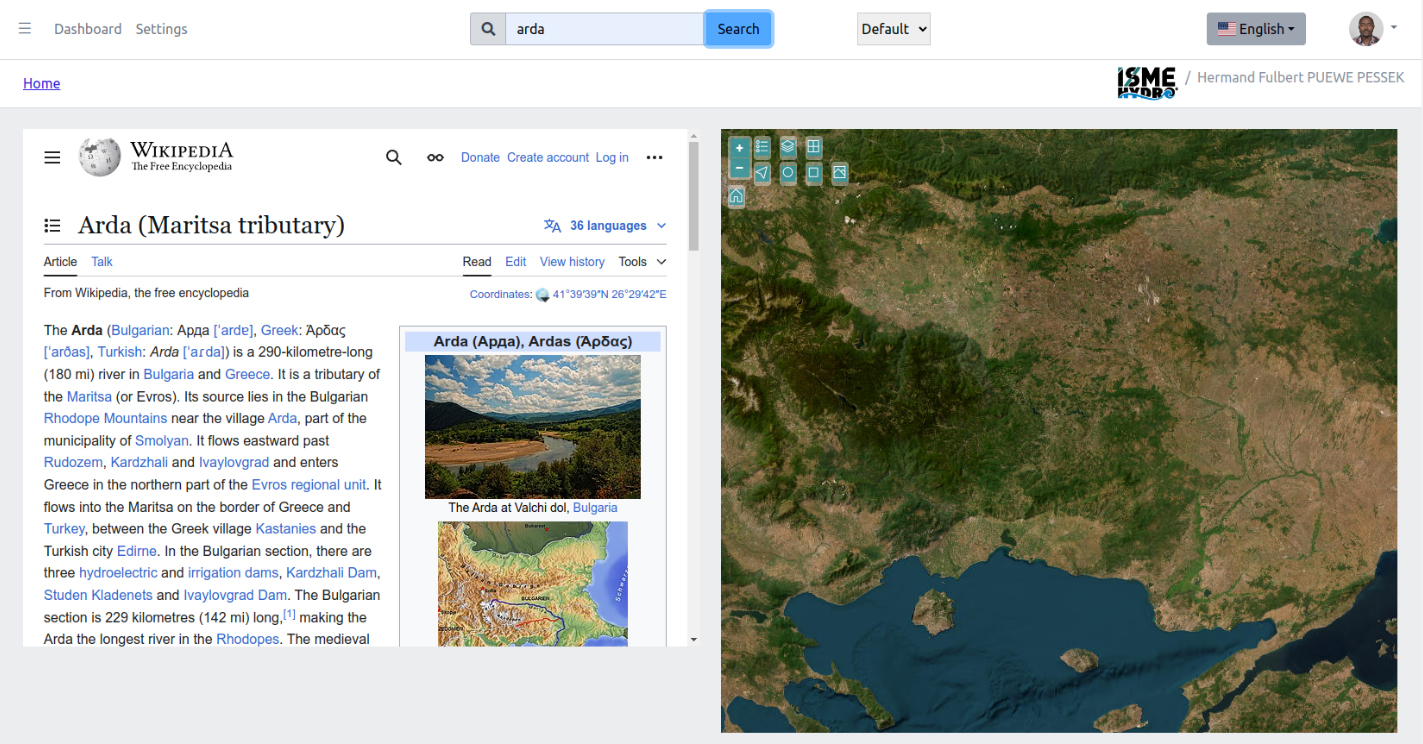
- Keyword search allows users to enter keywords to search out textual or geospatial information. The results of these queries show up in the query results panel, and the map view panel.
- Parameterized queries allow users to specify parameters that serve to formulate a custom semantic query of all possible correlations with the available data.
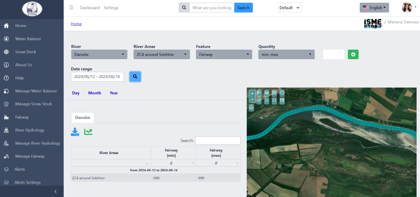
- Three global tabs, relating to time parameters, e.g. Day, Month, Year.
- Contextual tabs, allowing to navigate between different river information
- Map view, alternating between several map views, e.g. imagery, imagery with label, topographic, terrain with labels, light grey canvas and dark grey canvas and allowing GIS interactivity

The system does not simply retrieve data from data sources. Instead, it applies complex EO4AI techniques to generate forecasts for hydrological, hydrodynamic features of rivers and floods, drawing conclusions by mixing satellite data about precipitation, soil moisture, sunshine intensity, air temperature, vegetation index, turbidity, reflectance, and in-situ measurements from the river catchment to provide helpful answers related to fairways, the hydrological river status, or dam volume.
The scope of the prototype system is on the catchment of the rivers Danube, Arda and Rositsa in Bulgaria and on cascade Arda that is composed of three dams: Kyrdjali, Studen Kladenec, and Ivaylovgrad. The data that the system gathers from satellites, GIS and in-situ measurements cover the catchment of the rivers Danube, Arda, Rositsa and for the dams of the cascade Arda.
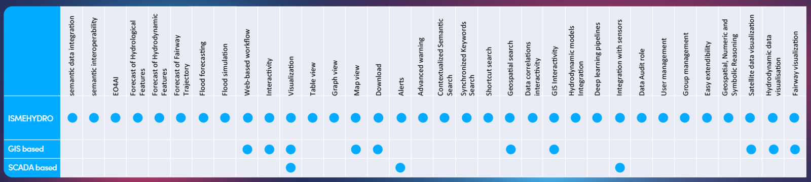
ISME-HYDRO® information system currently covers the following features:
We are ready to deploy the system or to provide forecasts in mode IaaS at short notice. Do get in touch with us. Contact: Mariana Damova, PhD CEO Mozaika, mariana.damova@mozajka.co